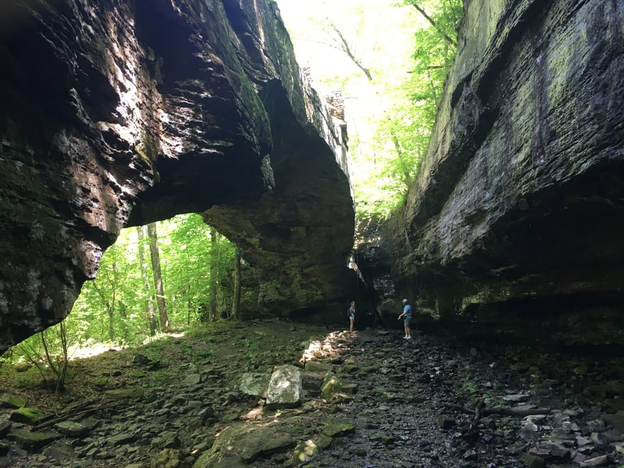
Alum Cove Natural Bridge AR
Motorcyclist Map
Places Filter: Landscapes
View In Google Maps: https://maps.app.goo.gl/avY4cBkKMKBzSRwbA
Description: Easy two miles off main highway on an all paved road. It’s an easy 1/4 mile hike down to the natural bridge which you can walk on and walk below. It’s a bit steep coming back uphill, but it’s an excellent trail maintained by the National Forest Service. The Alum Cove Natural Bridge is a remarkable geological feature located in the Ozark National Forest of Arkansas. This natural bridge was formed over millions of years through erosional processes. It spans 130 feet and stands 20 feet high, making it one of the larger natural bridges in the Ozarks. Visitors to Alum Cove Natural Bridge can enjoy a short hike to reach the site and can walk beneath the bridge, experiencing the unique geological formation up close. The surrounding area is also scenic, with opportunities for picnicking and enjoying the natural beauty of the Ozarks. The Alum Cove area is known for its karst topography, which includes sinkholes, caves, and underground streams. It's a popular destination for those interested in geology and outdoor enthusiasts seeking a natural wonder in the Ozark National Forest.