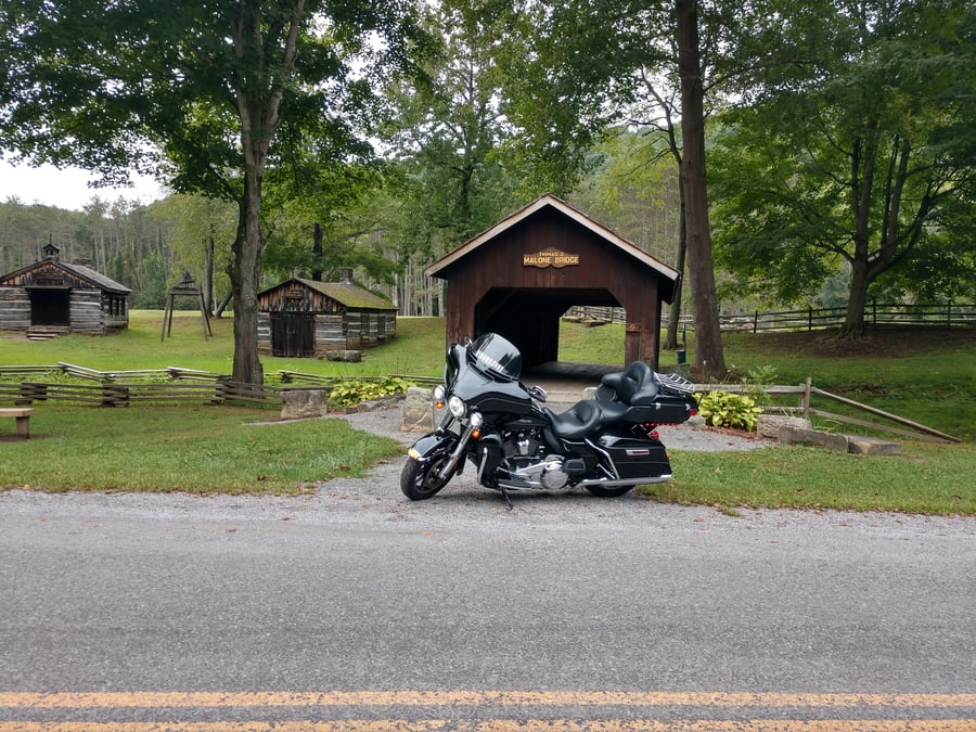
Thomas J. Malone Covered Bridge OH
Motorcyclist Map
Places Filter: Historic
View In Google Maps: https://maps.app.goo.gl/E5esMP8UjkSzvu1B8
Description: The Thomas J. Malone Bridge, a covered bridge measuring 42 feet in length, can be found within the pioneer village situated within Beaver Creek State Park. This bridge gracefully crosses a small stream along Echo Dell Road, all within the confines of Beaver Creek State Park. Interestingly, in the 1870s, this very bridge originally spanned the Middle Run River in Columbiana County. Over time, it underwent two relocations, converted into a storage shed, and saw its history temporarily obscured by the passage of time.