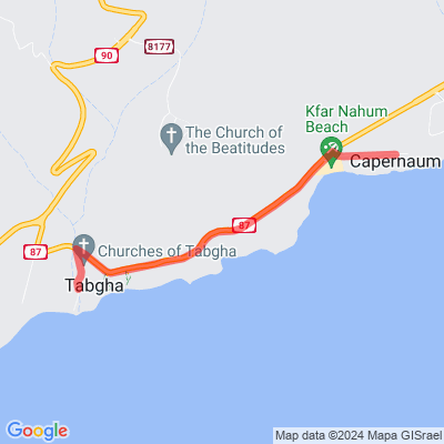
Tabgha to Capernaum
Motorcyclist Map
Route Suggested By: Helio Diamant - https://diamant.org.il/blog
View In Google Maps: https://maps.app.goo.gl/FX41NiWbrKqXzBi1A
GPX Download: https://drive.google.com/file/d/1tHjrCT1wZ7fnJ4ruT1xpYUwNx1tpMvgR/view?usp=sharing
Description: Capernaum, or Kfar Nahum in Hebrew, is a fishing village which was inhabited continuously from the second century BC to the 11th century AD, when it was abandoned sometime before the First Crusade. This includes the re-establishment of the village during the Early Islamic period soon after the 749 AD earthquake. In the excavations two synagogues were discovered, one over the other. As well, a house which was turned into a church has been discovered, and this is believed to be the house of St. Peter. At the site, one can visit the modern St. Peter's Church, and the archaeological excavation. Nearby the same site can be found the Kfar Nahum beach, and you can take some time to go and bath at the sweet waters of the Kinneret Lake. After all, you wouldn't be intending to visit the region without entering the waters of the Sea of Galilee, right?
Admin Country: Israel